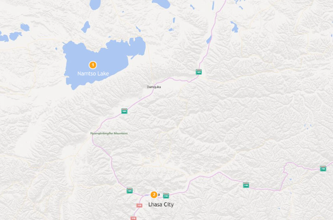
Lake Namtso Map: A Guide to Exploring Tibet’s Sacred Waters
Nestled in the heart of the Tibetan plateau, Lake Namtso is not only one of the largest saltwater lakes in Tibet but also a site of deep spiritual significance. Understanding the geography of Namtso can enhance your travel experience, making it easier to navigate the stunning landscapes and rich cultural heritage that surround this revered destination. In this article, we will explore the features of a Lake Namtso map and highlight the must-visit spots around this breathtaking lake.
Mapping the Beauty of Lake Namtso
When it comes to exploring Lake Namtso, a detailed map is an invaluable tool. It provides essential information on key locations, hiking trails, and viewpoints. The lake itself stretches about 70 kilometers in length, with various points of access. Key sites include the Tashi Dor Monastery, located on an island in the lake, where visitors can soak in both stunning vistas and spiritual ambiance. The map outlines not only the topography but also the accessibility of these locations, helping travelers plan their itineraries efficiently.
Understanding the Unique Geography
Lake Namtso lies at an impressive altitude of 4,718 meters (15,469 feet), making it one of the highest lakes in the world. Its unique saline composition gives it a striking blue hue that contrasts beautifully with the surrounding snow-capped mountains. The area is rich in biodiversity, boasting various species of birds and wildlife. A well-detailed map will help you identify the best spots for bird-watching and photography. Whether it’s the rugged landscapes or the serene waters, understanding the geography of Namtso through a map can lead to unforgettable experiences.
Cultural Highlights Around Lake Namtso
Beyond its natural beauty, Lake Namtso holds a significant place in Tibetan spirituality. Pilgrims often visit the lake to perform kora, a circumambulation of sacred sites. These trails are clearly marked on most maps, allowing visitors to join in this spiritual journey. Additionally, the nearby nomadic settlements provide insight into traditional Tibetan culture. Visiting these areas not only enriches your understanding but also offers opportunities for cultural exchange. A map can guide you through these local interactions while ensuring you stay on established paths for a safe and respectful experience.
In conclusion, a Lake Namtso map serves as more than just a navigational aid; it is a gateway to exploring the beauty and spirituality of one of Tibet’s most cherished locations. Whether you aim to trek, engage with local culture, or simply absorb the breathtaking scenery, understanding the map will help you make the most of your visit. For more information on planning your expedition to Lake Namtso, be sure to explore additional resources to prepare yourself for this remarkable adventure. Happy travels!